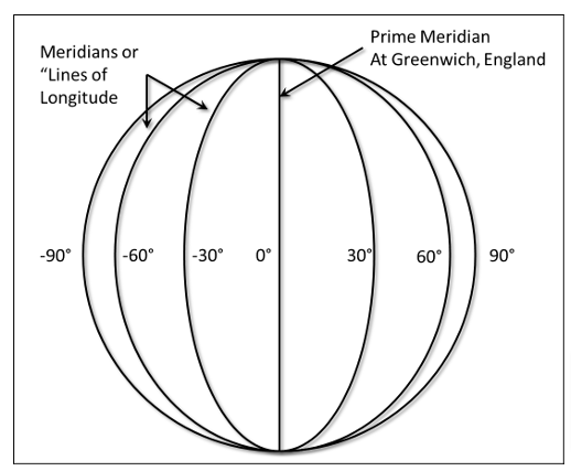
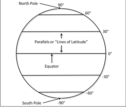
There exists a global address for all locations on the planet. Individuals can converse about place regardless of what dialect they understand since the address seems to be in numbers. The coordinates of a geographical address are two digits. A place’s longitude and latitude are represented by these two digits.
Un-projected or Geographic refers to how we define the Earth using spherical coordinates. “Latitudes” and “Longitudes” are the most often used systems for finding places on Earth. Latitude and longitude are both angles that are determined using the earth’s centre as the base. Longitude is defined as an angle calculated to the east as from the prime meridian. Latitude is defined as the angle measured upwards towards the equator.
Time Period and Longitudes –
Longitude and latitude are coordinate systems that may be used to identify and represent the location or position of every point on the planet. On a map or globe, latitude is a calculation of position south or north of the equator.
Longitude is a calculation of distance west or east of the prime meridian at London, Greenwich, which is a specifically defined fictitious north-south line running via both the south as well as north poles and Greenwich, London.
The intersection of latitude parallels and longitude meridians creates a framework or pattern from which exact coordinates in relation to the equator and the prime meridian may be established.


 Profile
 Settings
 Refer your friends
 Sign out